Category:Murrumbidgee Irrigation Area
Jump to navigation
Jump to search
food production system in south east Australia | |||||
| Upload media | |||||
| Instance of |
| ||||
|---|---|---|---|---|---|
| Location | New South Wales, AUS | ||||
 | |||||
Media in category "Murrumbidgee Irrigation Area"
The following 9 files are in this category, out of 9 total.
-

-
 Irrigation Canal along Crowes Road.jpg 1,500 × 997; 626 KB
-
 Irrigation canal at Yanco.jpg 788 × 600; 97 KB
-
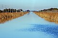
 Irrigation canal Murrumbidgee.jpg 574 × 353; 58 KB
-
 Irrigation canals from the Murrumbidgee River (NSW) (9318315860).jpg 2,000 × 1,263; 354 KB
-
 Irrigation Channel in the MIA.jpg 4,272 × 2,848; 2.6 MB
-
 Map of the Murrumbidgee Irrigation Area.jpg 800 × 570; 100 KB
-
 MerungleHillPumpingStation.JPG 2,272 × 1,704; 793 KB
-
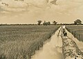 Rice fields near Leeton.jpg 588 × 417; 58 KB


_(9318315860).jpg)


